Sunday, 25 July 2010

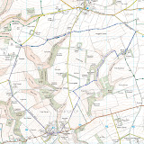
Warter Circular Walk 25 July 2010


I had an earlyish start today; I was walking along the Roman Road out of Warter by ten o’clock, after a twenty-odd drive from home. The route started with a steady near four hundred foot climb up to the wold top in hot and humid conditions.

The Wolds aren't high, but they stand proud from the surrounding plains giving extensive views: Holderness, the Vale of York, Hull and, over the Humber, Lincolnshire. The wind farm at Lissett is a new feature of views from the Wold tops, giving a good indication of the coast south of Bridlington.

The lanes hereabouts are quiet and not at all unpleasant to walk along. Indeed, on this Sunday morning, the four or five  passing bicycles easily outnumbered cars. The tarmac was left at Cobdale Cottage to join a terrific green lane, the Hawold Bridle Road, for the next three miles.

I’d last been this way about five years ago when walking the Minster Way, a route between Beverley and York. Since then Well Dale, running south from the track, has become open access land. My impression is that the landowners aren't over enamoured with the new arrangements: the information board has been vandalised with a nail, the access gate is festooned with a home made notice, “Warning Gas Guns in Operation!” and a new fence has been imposed on the landscape. Despite these minor annoyances, and despairing of the selfish attitude of the few, the walking was grand.

The track passed a large area of polytunnels filled with strawberries, enough to accompany a tanker full of cream. The aroma was magnificent. Scorning temptation I passed without sin.

I left the Minster Way at Blanch Farm.

Lavender Dale is now Open Access land allowing an easy walk along the dale bottom instead of clinging to its top edge. After a steep pull out of the dale there were more fine tracks before joining the lane just outside Warter.

I’m afraid my not-so-new boots continue to wreck my feet. I’d bought new insoles thinking they might help: a pair of Sorbothane type ones and a pair of light Odour Eater type. I started well with the heavy duty insoles until my heels became sore. I swapped to the lightweight ones which promptly rucked up inside my boot before being discarded. The net result of my experiment was painful, skinless heels. Back to the drawing board.

Feet apart, I was fine...     

The day’s walk was a shade under ten miles. The route was courtesy of East Riding of Yorkshire walking website.


Sunday, 18 July 2010

Fordon Circular 18 July 2010


I had a short, but sweaty, five mile, local walk today, from the hamlet of Fordon. It’s a walk I’ve done quiet a few times over the years, with variants and as part of longer outings; the last time being in August 2008, just before my Coast to Coast walk.

The route explores dry Wolds valleys and touches briefly on the Yorkshire Wolds Way.

The way has improved since my last visit; the addition of a new style into the eastern extremity of access land at Fordon Banks saves a good half mile of road walking and substitutes flower, bird and insect rich, unimproved, chalk grassland, for tarmac (the half dozen hares and a Sparrow Hawk, disturbed on my traverse, seemed to enjoy it too).

The walk uses an green lane from East Dale onto the Wold top at Danebury Manor. The old farm house was in a sorry semi-ruinous state in 2008, but has now been resurrected and is in the final stages of a complete renovation (it could be now two, if not three, new dwellings).

As usual the Wolds Way showed no sign of walkers, nor did Lang Dale or North Dale on the pleasant walk back to Fordon. The big black bull in a field near the hamlet, fortunately, was more interested in his harem than my presence.     

Sunday, 11 July 2010

Walks Update

It’s a while since I last updated the Walk Diary. I didn’t manage the hoped for September expedition last year for family reasons. Despite this spell of indolence, and the unfortunate addition of a wee bit of weight, I’ve not been entirely inactive.

Windermere Way (about 8 and 13 miles)

After Easter we had a few days in Ambleside, cut short by Rita developing the lurgy. I did, however, manage to walk a couple of sections of the Windermere Way on the 11th and 12th of May, 2010.

I say walk, at times it was something of a hobble. I’m afraid I always have a lengthy bedding-in period for new boots while my feet assume the shape of the unyielding bits of the shoe last. In fact my boots traditionally only become truly comfortable in the last few miles before they fall apart.      

The first segment was between Windermere and Ambleside. There was a fair covering of snow on Fairfield and even a flurry just below the modes, but rewarding, summit of Orrest Head during the morning. Despite this, the weather was generally grand and the surroundings superb.

The route scales Wansfell Pike the easy way: via Robin Lane and the Hundred Road. I think I’d been up there as a lad, but, if I had, I’d forgotten just how steep the drop to Ambleside is. A trip up and down once a week would make an athlete of a sloth.

The following day’s route was generally pretty good too: Ambleside to Ferry House, via Loughrigg Fell (I dodged the option to revisit the top), Loughrigg Tarn, Skelwith Bridge, Wray Castle, Belle Grange, and Claife Heights.

The segment between Ambleside and Skelwith Bridge is magnificent and well trodden. From there to Wray Castle, however, is mainly on lanes and best done quickly to gain the lake shore and the unfrequented (at least by me) Claife Heights. It’s quite a pull up to the heights but well rewarded by views across Windermere to the Howgills and on to Ingleborough.

Rosedale Circuit (about 12 miles)

I was next out on July 1 for a trip round the head of Rosedale using the track of the old ironstone railway: Rosedale Abbey, Northdale, East Mines, Dale Head, Sheriff’s Pit, Thorgill and Rosedale Abbey. This, with variants, is a favourite outing: an hour’s drive from home to the heart of the North York Moors. But it was hot… And the boots hurt my feet…

I was more than a little concerned that the years have begun to catch up with me and I’d permanently lost my stamina. I walked slowly, frequently had to pause and, more often than I should, needed to take longer breaks. Still, I did do the round, albeit taking an hour or more longer than I would have expected. Despite all, it was enjoyable; painful but agreeable.   

With a multi-day outing pencilled in for September (the exact dates being subject to some surgery Rita’s having) I’m hoping to get in at least one decent walk (ten miles, plus) every week. So, blisters healed, it was out into the heat again today.

Flamborough Cliffs (about 10 miles)

I stayed local with another favourite, a walk circular walk from Flamborough: out onto North Cliff, following the cliff top to North Landing, Flamborough Lighthouse, South Landing, Beacon Hill, Beacon Farm and back to Flamborough.

I felt a whole lot better today: stamina much improved with far fewer “photo stops” and rests. This in spite of the day being, if anything, hotter than during the Rosedale outing. I might not be due for the knacker’s yard for a while yet after all!

The walk was marked by an abundance of wild flowers (I’ve just bought a book so might be able to name them soon), butterflies, moths and seabirds. There were plenty of people about too, particularly for the half mile either side of the road access.

The path diversion remains at Thornwick Bay, necessitating a lengthy loop inland instead of the former and preferable drop to, and climb from, beach level. It is now beginning to look permanent. The diversion uses a permissive path, which continues through, or beside, the caravan site and links with the outward path from the village. This path might prove a better option for future visits.  

I’ll post some photos of the trips when I recover from a technical hitch with my IT.

Now then, where’s the map? Where to next week?

Monday, 8 June 2009

Wharrem Percy, Thixendale Circular (Monday 8 June 2009)

Near Thixendale
Towards the dale of Thixen Dale
Descent to Thixendale
Honey Dale

Medieval gravestone set into Wharrem Percy church wall

Fish pond, Wharrem Percy
St Martin's Church Wharrem Percy

I’d bought boots over the weekend, a pair of Brasher Lithium XCRs. Today was a leave day, bright, but not too warm; time to test-drive the new footwear.

In view of the sensitive nature of my feet I decided against anything too challenging and opted for a revisit to the Wolds for a favourite walk last done in July. So, off to Wharrem Percy it was for an eleven o’clock start from the medieval village visitor car park.

The walk is a popular outing and uses a figure of eight route alternating between parts of the Yorkshire Wolds Way and Centenary Way. I varied the walk over past visits by visiting Vessey Pasture Dale on the outward leg and entering Thixendale from the west. This, incidentally, seems the slightly easier option, using the steep Wolds Way path at Thixendale in descent.

The boots seemed comfortable at first, light, with plenty of support. As the day progressed, however, I developed hot spots on the soles of both feet which, by the end of the walk, had developed into full blown and rather painful blisters. I don’t think this is a fault of the boot; it’s just the usual war of attrition I always have to endure before my feet accept new footwear.

It was pretty quiet on the route: I passed just one other set of four walkers and a morose youth sat in a farm vehicle using all of his limited ingenuity to ignore my presence. There was plenty of bird and insect life on display, including lots of tortoiseshell butterflies, but no larger animals.

The pub at Thixendale was closed but I found a reasonably restful perch at the village cricket pavilion to chew my banana and apple and air my toes. It got pleasantly warm during the middle of the day with surprisingly strong sunlight: enough to lightly toast exposed skin.

The highlight of the return leg is the descent into Deepdale and Wharrem Percy. Wharrem Percy has a very agreeable setting which always attracts a smattering of visitors. In truth there’s not a lot of the medieval village to see, just humps and bumps on the ground, a pond and a ruined church. There are plenty of interpretation boards, however, and even the least imaginative can get some appreciation of the site’s past.

I finished the ten mile walk blistered, sweaty and sunburnt: I must get back into a regular weekly walk routine to regain some of the fitness I had at the end of last year’s Coast to Coast walk.

Tuesday, 26 May 2009

That was the walk that was…

Well, it’s already a month since my last outing. "The Inn Way…to the Yorkshire Dales” route was a good walk too. Large sections were superb, particularly the first two legs. I must try to wangle a long weekend and walk the last couple of legs back to Grassington.

If there was a criticism it’s that there was perhaps a shade too much road walking, especially on the Askrigg to Reeth section. That said, the roads were very quiet and the landscape superb, even in driving rain and mist. It’s also difficult to see any obvious alternative on the map using established paths and tracks.

I was generally pleased with my physical performance, although a loss of condition over winter was all too obvious. I got one small blister on a big toe and sprouted spotty loins, presumably from walking in waterproofs. I otherwise survived unscathed.

My Meindl boots continued to disappoint. They leak and the heel is again becoming detached from the main body of the boot. They will have to be replaced soon – not by another pair of Meindls. Considering their cost and the fact that they’ve already had one factory repair, only 350 miles of use is abysmal performance: it works out at around 37p a mile.

I’ve used Pacerpoles for a year or so now and they’re now second nature. Despite looking faintly ridiculous to a casual observer I now consider them to be essential kit. They should come with hazard lights, however, to warn and protect bystanders and passers by: God knows how I’ve not skewered some other hapless rambler.

I’ve not yet decided on the year’s main project. I still fancy a trip to Bowness to walk the Windermere Way as a starter. It would be possible to arrange that as a single base trek, allowing Rita to have a (non-walking) break too. I’ll have to negotiate a longer solo expedition, probably in September. Maybe another of Mark Reid’s walks, “The Inn Way… to the English Lake District”.

Saturday, 23 May 2009

Reeth to Carperby

Wednesday 28 April 2009

(Walking Distance: 11 miles)

Greets Hill

Bolton Castle

Breakfast was interesting. All the other guests were members of the vocal ladies walking group last met in the Kings Arms. They were, like me, heading home today. Coincidentally the walk leader came from Swainby, near Northallerton, my lift, John’s, birthplace. She knew his brother.

It was a dry, pleasant, if hazy, morning. I left for what I’d anticipated to be an easy ten mile walk to Aysgarth, where I’d arranged to meet John. The route headed south over moorland back into Wensleydale, crossing Apedale, an intervening valley, before descending to the River Ure.

Except in complicated surroundings I try to avoid walking with my nose in the map, preferring to study the route beforehand and navigating from memory, with only occasional reference to the Ordinance Survey or guidebook. This approach usually works well leaving the mind free to absorb and admire the surroundings. It does, however, have some drawbacks

I walked up the lane, passing a minor junction and the youth hostel, before hauling myself up onto the open moor. I was looking for a track off to the right: I found one but it didn’t quite match the description I’d read earlier. I belatedly consulted the map and realised I’d missed the lane to Redmire and continued along the road to Leyburn.

The good news was that I heard the first cuckoo of the season on the way up. The bad news was the two and a half miles extra distance and three hundred foot of wasted ascent.

Eventually I got back on route and found the track across the moor to the day’s highpoint, Greets Hill. The weather didn’t deliver the promised vista, however. Whilst the mist wasn’t bad enough to hinder navigation it limited the view to just a mile or two.

Apedale was suitably bleak, Black Hill was almost easy: might be getting fitter? I stopped for a break above Bolton Castle when the sun finally appeared.

It was getting near the three o’clock appointment with my lift. In the pastures after Bolton Castle my phone sprang to life, the first signal of the trip. It was John. Another half mile and I was done.